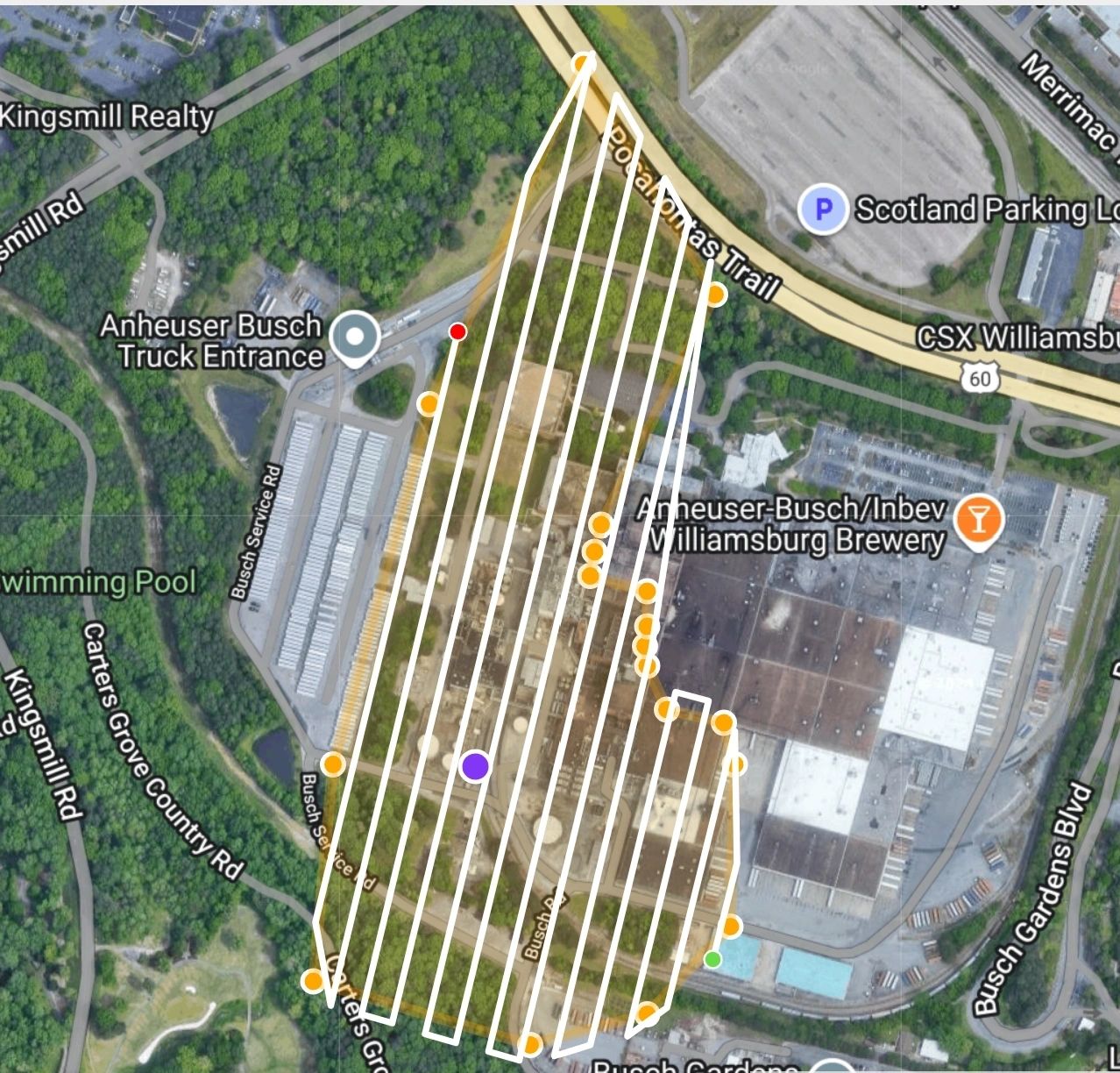
Image Mapping
- Home
- Image Mapping
2D,3D Mapping, RTK and Photogrammetry,
At I Fly Drones LLC, we specialize in using advanced drone technology to deliver high-precision 2D maps, 3D models, and photogrammetric data to revolutionize your construction monitoring. Our innovative aerial solutions help you track progress, plan effectively, and reduce costs while improving safety on site. Whether you’re working on a small project or managing a large-scale development, our drone services are tailored to meet your specific needs.
Drone Survey Services
2D Aerial Mapping
Accurate, high-resolution 2D aerial maps provide a bird’s-eye view of your site, offering a wealth of information that traditional ground surveys cannot match. These maps are created using georeferenced images captured by our drones, RTK and PPK can be used for centimeter accuracy allowing you to monitor site boundaries, plan layouts, and track progress in real time.
Key Benefits:
- Up-to-date visual data for project stakeholders
- Quick identification of site changes
- Cost-effective for large and difficult-to-access areas
- Supports GIS integration
3D Modeling
With our drones, we create detailed 3D models of your site using advanced photogrammetry. These models help you visualize terrain, structures, and materials in a real-world context. Our 3D models are ideal for pre-construction planning, site analysis, and ongoing progress reporting.
Key Benefits:
- Immersive, realistic representations of your site
- Supports volumetric calculations (e.g., stockpile measurements)
- Facilitates clash detection and design validation
- Enables better communication with clients and stakeholders
Photogrammetry
Photogrammetry is a cutting-edge technology that uses drone imagery to create accurate measurements and topographic data from aerial photos. By stitching together multiple high-resolution images, we produce precise and measurable 2D and 3D outputs.
Key Benefits:
- High precision and detail for surveying and mapping
- Enables accurate land measurements and elevation data
- Saves time compared to traditional survey methods
- Useful for contour mapping and earthworks calculations

Industries We Serve
- Construction & Infrastructure: Monitor site progress, inspect structures, and manage logistics.
- Real Estate Development: Create stunning marketing visuals and 3D tours for prospective clients.
- Mining & Aggregates: Measure stockpiles, map terrain, and track operations.
- Agriculture: Map fields, assess crops, and monitor irrigation systems.
Reasons to use Drones
- Accuracy & Efficiency: Our drones use state-of-the-art sensors and GPS technology to ensure that every image and model we produce is accurate to within a few centimeters. This level of precision helps you make critical decisions faster, with confidence.
- Time-Saving: We reduce the time spent on manual surveys, allowing for rapid data acquisition across large areas in a fraction of the time it would take with traditional methods
- Safety First: With drones, we can access hard-to-reach areas without putting anyone at risk. No need to send workers to potentially hazardous locations—our drones do the job safely from above
- Cost-Effective:Drone technology helps you save on labor, equipment, and time while providing a better overview of your site. Plus, you’ll avoid costly delays thanks to the up-to-date information we provide.
Industrial Drone Survey Pricing Table
| Service | Pricing Model | Starting Price | Details |
|---|---|---|---|
| 2D Aerial Mapping | Per Acre / Per Project | Starting at $50 per acre w $400 minimum |
|
| 3D Modeling & Site Visualization | Per Project / Per Hour | Starting at $1,200 per project |
|
| Photogrammetry Survey | Per Acre / Per Project | Starting at $100 per acre $1000 |
|
| RTK (Real-Time Kinematic) Mapping | Per Acre / Per Project | Starting at $50 per acre $500 Minimum |
|
| Volumetric Measurements | Per Stockpile / Per Acre | $500 per stockpile site |
|
| Construction Progress Monitoring | Weekly / Monthly Subscription | $500/monthly $350/Weekly |
|
| Custom Aerial Inspections | Per Hour / Per Day | $200 per hour, $1,500/day |
|
| GNSS Point Creation & Ground Control Points (GCPs) | Per Project | Starting at $500 per project up to 4 GNSS points $100 per additional point placements |
|
Additional Costs & Considerations
Travel Fees: For locations outside a 50-mile radius of our headquarters, additional travel fees may apply. Contact us for a custom quote based on your project location.
Expedited Services: Need results quickly? We offer expedited processing for an additional $300 per project, delivering results within 24-48 hours.
Subscription Discounts: Long-term or recurring projects qualify for discounted rates. Ask us about weekly, bi-weekly, or monthly packages to save on continuous monitoring services.
Our Partners and Affiliations
- Real Estate Photos and Video
- Construction Site Surveying
- Image Mapping
- Social media
- Film, Broadcast, and Social media content
- Public Safety / Search & Rescue
- Thermal or Infrared Imaging
- Photogrammetry
- Festival & Concerts
- Live Streams
- Sporting Events
- Memorial Services
- Drone Training
- Drone Repair
- Rentals
- Agriculture and Pond Management Services


